Giorgos Mountrakis, Ph.D.
Founder & Director | Intelligent Geocomputing Laboratory
Professor | Dept. of Environmental Resources Engineering | State University of NY College of Environmental Science and Forestry
Associate Editor | ISPRS Journal of Photogrammetry and Remote Sensing
Multiple Ph.D. Assistantships available for August 2024
Deep Learning in Remote sensing
The Landsat archive, with a multi-decadal global coverage is a prime candidate for deep learning classification methods due to the large data volume. We used 21 million labeled annual temporal sequences to compare deep learners with traditional methods. Results indicate substantial classification improvements of deep learning methods (DLMs) over the RF. These improvements are more pronounced on challenging to classify pixels in heterogenous areas. RF classification accuracy reaches about 70% on average, while DLMs are at 86%-95% range, depending on model architecture. See more here.
Remote sensing research highlights
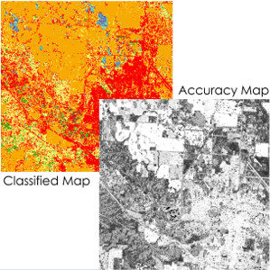
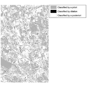
Creation of pixel-based accuracy maps for RS classification
Read More
Fifteen years of published land cover classifiers
Read More
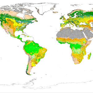
Review of global and regional land cover products
Read More
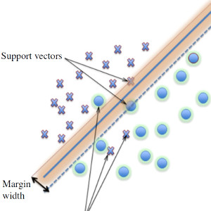
Support Vector Machines in RS problems
Read More
RS multi-step classification using intermediate results
Read More
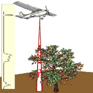
Accurate ground detection in waveform LiDAR signals
Read More
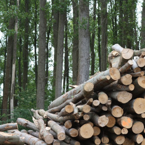
Biomass estimation using waveform LiDAR signals
Read More
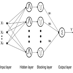
A novel multi-scale regression and classification method
Read More
Interdisciplinary research highlights
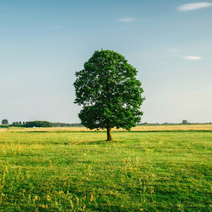
Forest attrition is higher in the Western US, in public and rural lands
Read More

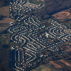
High urban land consumption linked to lower African American population, higher poverty rate and lower income per capita
Read More
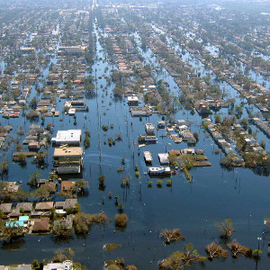
Hurricane Katrina flooding disproportionately affected African American neighborhoods
Read More
Urban growth prediction models: Challenges moving forward
Read More
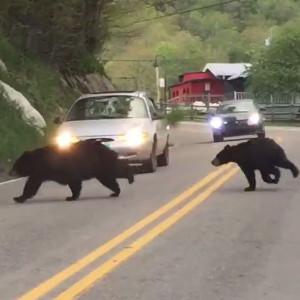
Wildlife vehicle collisions: A review of geographic models
Read More
News highlights
2023. Apr: Special Issue on Deep Leaning on the Landsat Archive Announcement
2022. Jan: Grant from SRC Inc to develop deep learning classifiers for remote sensing
2021. Mar: Grant from NASA to develop a rewilding decision support environment for tortoises in the Galapagos.
2020. Mar: Grant from the Healthy Water Solutions Center of Excellence to incorporate satellite measurements in water quality assessments.
2019. Dec: Grant from Onondaga County to monitor harmful algal blooms using satellite observations.
2018. Sept: Promoted to Professor.
2017. Feb: NY Times and Washington Post covered our forest attrition work.
2015. May: SUNY ESF Exemplary Researcher Award Announcement
2015. Jan: New grant from NASA to study Grazing Systems in the Altai Mountain Transboundary Zone.
2015. Jan: Associate Editor for the ISPRS journal.
2014. Mar: New grant from USDA McIntire-Stennis Program to study uncertainty in satellite-derived forest maps.
2013. May: Promoted to Associate Professor with tenure.
2012. Sep: Received the Excellent Reviewer Award by ISPRS.
2012. May: Invited Keynote Speaker at the 32nd EARSeL Symposium (European RS).
2011. Sep: An educational paper on inquiry-based learning in RS courses was accepted.
2011. Apr: Students presented the space balloon project at the National Conference on Undergraduate Research.
2010. Nov: A review paper on SVM methods was accepted in the ISPRS journal.
2010. Jun: After invitation attended UN FAO meeting in Rome, Italy.
2009. Aug: Full patent awarded by the USPTO on multi-scale neural networks.
2009. Jan: New grant from NASA to study spatiotemporal relationships between bird migration and climate change.
2008. Oct: Guest Editor for a PE&RS Special Issue on Artificial Intelligence in Remote Sensing.
2008. Aug: Recipient of NASA’s prestigious New Investigator Award to study urban dynamics.